Tuesday, December 25, 2007

Orroroo Reservior.

Orroroo is a small country town in the southern Flinders Ranges some 260km north of Adelaide in South Australia. The Reservoir was constructed in 1906. It originally held approximately 1,540 mega litres of water and was used by settlers for growing Lucerne and in dairies. In 1973 silt build up, insufficient rainfall and erosion caused the reservoir to be abandoned.

This will be the last posting from us as we head to the Great Ocean Road tomorrow and then onto The Grampians before returning home and back to work.


--------------- ----------------- ----------------- -------------- ---------------


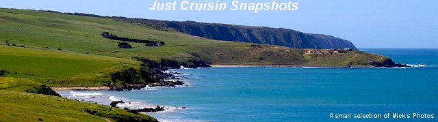
For those who would like to have a look at the Great Ocean Road, more information can be found at this Web Site. The image below is displayed on the site listed.


Information on The Grampians can be found at this Web Site


Monday, December 24, 2007

Merry Christmas.


Merry Christmas everyone. May Santa bring you all the happiness that you deserve and much more.

Sunday, December 23, 2007

Black Rock.


This photo is of the old Black Rock Hotel in the small South Australian town of Black Rock in the mid north of the state. The photo was taken during the afternoon with the sun behind the Hotel so it is a bit darker than if it were taken mid morning, perhaps a different time of the day next time.

Wednesday, December 19, 2007

Yule River.


Bridge crossing over the Yule river in Western Australia within the Pilbara region. This photo was taken in August 2004 and at that time of the year there normally would not be water in the river. To be able to camp along side of the river while there was the water in it, made it even more memorable for us.

Tuesday, December 18, 2007

Smoko in the bush.

This is what you call smoko outback style. It was good to be able to pull up when in the outback, light a campfire and boil the billy and then enjoy a good cup of bush tea. This location was near the Gawler Ranges South Australia on a recent weekend trip that we enjoyed.

Sunday, December 16, 2007

Dry Times.


Dry times in the Southern Flinders Ranges of South Australia looking across the plains towards Orroroo from the hills above Melrose.

Saturday, December 15, 2007

Blue Lake.


Mount Gambier's Blue Lake is bright blue during the warmer period of each year as seen in this photo. The water is crystal clear to look at when up close when the lake is blue. During the off time of the year when it isn't blue, the lake appears to be a dark blue/green colour.

Wednesday, December 12, 2007

Wallaroo Sunset.


While visiting Wallaroo South Australia last weekend, we were privileged to see this sunset over the main shipping wharf.

Wednesday, December 5, 2007

River Camping.


Found these lucky campers on the bank of the River Murray near Parings South Australia in a Caravan Park called The River Bend Caravan Park. It is a relaxing time to be able to sit on the water edge and watch the day go by without a worry in the world, well we hope without a worry in the world.

Tuesday, December 4, 2007

Roses.


An image of some our our roses in the front garden.

Monday, December 3, 2007

Bridge.


A cloudy late morning photo taken looking south from Garden Island here in Adelaide South Australia. It was a cold and windy day and although you can not see the fisherman, he was standing in the water along side of the bridge. One hopes that he was catching some fish to make it all worth while.

Sunday, December 2, 2007

Green Hills.


With these hills facing west and the late afternoon sun shining on the green grass along the Fleurieu Peninsula, it gave the afternoon a false indication of what the day was really like. Overcast for most of the day with dark shadows, these few moments were an exseption to the rule.

Saturday, December 1, 2007

Renmark.

Renmark is located in the Riverland 256 km from Adelaide when heading towards Sydney New South Wales. This photos shows the main wharf area where houseboats are able to tie up and walk to Renmark's shopping outlets to replenish groceries.

Friday, November 30, 2007

Murray River South Australia.


This photo was taken at the same location as yesterday's photo was taken. This one like yesterday's photo was taken using a polarizing filter.

Thursday, November 29, 2007

Murray River South Australia.


Captured this photo while out driving along the Murray River between Lyrup and Renmark in the Murray River National Park Lyrup Flat. A polarizing filter was used with this one to bring up the colour of the duck weed seen here floating on the water.

Wednesday, November 28, 2007

Paringa Bridge.


While at Renmark for the weekend, we saw the Paringa bridge lift up to allow houseboats through. The bridge has been operating since 1927 and lifts up to allow river traffic through only two time a day, the first being at 9.30am and the second at 2.30pm. Should the bridge be required to operate outside of these two time slots, prior arrangement must be made with the operator.

Tuesday, November 27, 2007

Garden Island.


This photo was taken at an area known as Garden Island which is an area of reclaimed land here in Adelaide South Australia. In the distance you can see a jetty which was built along the mangroves for the purpose of recreational fishing. On a calm day, the water reflections in this area are great if there at the right time.

Thursday, November 22, 2007

Causeway.


The tourist town of Victor Harbor is located 80 km south of Adelaide, South Australia. One of the main attractions to Victor Harbor is Granite Island, and the causeway access is shown here in this photo.

Wednesday, November 21, 2007

Painted Desert.


The area known as the Painted Desert is located in the north of South Australia some one hundred kilometres east of Cadney Park Homestead. The road out to the painted Desert is all unsealed and can be very rough to drive on. This photo shows one of the many land formations which make up the Painted Desert area.

Tuesday, November 20, 2007

River Torrens.


Following on from yesterday's post, we parked the car near the Zoo and set off on foot to walk the banks of the River Torrens. From the Zoo we headed west along the northern banks of the Torrens until we arrived at the weir for a short break before returning on the southern side making our way back to the Zoo and vehicle.

This photo was taken from the southern side looking back into the city, not all that far down from the Zoo. At times the water was smooth as seen here making for a very pretty location.

Monday, November 19, 2007

Adelaide CBD


It was a spur of the moment decision yesterday to drive into the city for a casual walk along the River Torrens. It has been something that we have been going to do for some time now so with a warm afternoon and full sun we thought we would give it a go. This photo is looking south across the park lands into the main part of Adelaide.

Sunday, November 18, 2007

Boats.


Captured this photo at Glenelg, a suburb of Adelaide South Australia. We had first headed for West Lakes to capture some water reflections before we finally ended up at Glenelg.

Saturday, November 17, 2007

Ormiston Gorge.

Ormiston Gorge forms part of the West MacDonnell Range in the southern parts of the Northern Territory of Australia and is located 135 km west of Alice Springs via the Larapinta and Namatjira Drives.

The gorge has a near permanent waterhole estimated to be up to 14 metres deep at its southern end. The area is accessible all year round with its own camping ground and toilets for visitors to use.

Friday, November 16, 2007

Wangarra Lookout


Wilpena Pound forms part of the Flinders Ranges in South Australia and is situated 481 km north of Adelaide. First class sealed roads allow easy access for tourist to visit the area.

Wangarra Lookout is accessed from Wilpena Pound Resort and can take up to two hours for the return walk to be completed. A short walk up Wangarra Hill behind the Hills Homestead takes you to the lower (5 mins) and top (20 mins) lookouts which offer panoramic views of Wilpena Pound.

Thursday, November 15, 2007

Uluru


Uluru sometimes called Eyers Rock, is located 440 km south west of Alice Springs at the bottom of the Northern Territory in the centre of Australia. The country side is flat for miles around with the exception of Uluru which can be seen from far away.

There is a good sealed road for motorist to use to visit the attraction, there is a large commercial airport based at Yulara Resort. Many tour operators run from Alice Springs to Yulara on a daily basis offering an array of tours to those who don't want to drive themselves. Entry permits are required to visit the area and are available at Yulara.

Wednesday, November 14, 2007

Hogwash Bend Sunset.


Hogwash Bend is an area on the River Murray between the river towns of Waikerie and Morgan in South Australia. The area is a very popular camping location with spectacular river views.

While we were camped there, this photo was taken late afternoon while the sun was setting giving that golden glow across the water and onto the trees.

Tuesday, November 13, 2007

Chamber's Pillar.


Chamber's Pillar can be found in a 340 hectare Reserve 160 km south of Alice Springs in the Northern Territory of Australia. The road into Chamber's Pillar is unsealed and can be closed after heavy rains in the area.

The Pillar towers 50 metres above the surrounding plain and history has it recorded that sandstone deposits were laid down in the area 350 million years ago. Since then wind and rain have eroded away the softer material, leaving this solitary column of pebbly sandstone.

Monday, November 12, 2007

Sharing the Road.

When traveling north from Port Augusta in South Australia through to Darwin in the Northern Territory, these two road users share the same highways.

The large triple road train rolls along at speed up to 100 km per hour while the smaller 4WD & caravan will move along at speeds averaging approximately 90 km per hour. Most with common 2 way radio communication share the roads in harmony.

Sunday, November 11, 2007

Canola Crop.

This crop of Canola was captured to film during 2005 on our return trip to Adelaide from Wilpena Pound in the Flinders Ranges of South Australia. The actual location was near the small township of Riverton approximately 80 km north of Adelaide.

When the bright yellow flowers of the Canola crop are displayed in the sunshine with the surrounding green paddocks close by, it offerers great opportunities to capture the contrasting colours to a photo.

Saturday, November 10, 2007

Traphina Gorge


Traphina Gorge is part of the East MacDonnell Ranges and is 85 km east of Alice Springs in the Northern Territory. While the East MacDonnell Ranges isn't visited like the West MacDonnell Range is, it still offers some very nice scenery.

Traphina Gorge is noted for its sheer quartzite cliffs and River Red Gum lined watercourses and offerers wide sandy creek beds with some water holes if you are there at the right time. The waterhole in this photo was home to hundreds if not thousands of Zebra Finches which would fly away if disturbed only to return back near the water soon after.

Friday, November 9, 2007

Rainbow Valley


Rainbow Valley is located to the east of Stuarts Well in the centre of Australia up in the Northern Territory. Whilst the 22 kms of dirt between the main road and the valley can be very rough, the drive in is well worth it particularly if you are able to witness a sunset.

Many people as we did use Stuarts Well as a base camp if visiting the area. The area in the foreground of this photo sometimes fills with water after heavy rains and offers some very magnificent water reflections, it is just a pity that it is so far away from home.

Sunday, October 14, 2007

Next Post.

My next post will not be until after I have finished doing these 12 hour shifts at work. They consume so much of one's time that there is very little for anything else.

Perhaps mid next week will see some postings starting to appear.

Mick.

Saturday, September 22, 2007

Sand Hills


After being away for several weeks, we are back with lots of photos that have been taken between Port Augusta in South Australia to Alice Springs in the Northern Territory.


These two were taken near Yulara in the Northern Territory and show how red the sand is in that region.

It depends on the time of the day as to how red the sand will appear. The sky will also change it's blue to a very deep and amazing colour.

Wednesday, August 15, 2007

Adelaide at Night.


The main Victoria Square fountain in the centre of Adelaide's CBD taken during late afternoon while were were waiting for darkness.


Once it was dark, we started to click away and finished up with this one amongst many others.

With the light shining on the water and the slow shutter speed, this effect was achieved.

Monday, August 13, 2007

Houseboats.


House boats on the River Murray come in all shapes and sizes from accommodating only two people to just about as many as you like.

While this houseboat may look small, it will accommodate up to 12 people in luxury style.


Luxury plus, with this multi story houseboat from the Unforgettable range.

This one found itself stuck on the sand when it wanted to move off, something any size houseboat needs to be careful of when berthing for a period of time.

Sunday, August 12, 2007

Murray River South Australia.


The creeks and low lying flood areas that are filled with water from the Murray River are known as backwaters.

As there is very little water movement within the backwaters, it allows more reeds and water plants to grow as seen here.


The brown cover seen here is a ribbon type weed which grows where the water is still and allows the water below to become crystal clear.

These backwater areas can be very pretty to look at and offer a peaceful location to all of those who visit the area.

Friday, August 10, 2007

Old Buildings.


These buildings are a part of the old Wilpena Homestead which is located at Wilpena Pound in the Flinders Ranges in South Australia.


These buildings have been maintained to their original condition and layout.

With the green grass seen in these photos, it is easy to see why the early explorers first thought that it was a suitable area for cereal cropping.

Thursday, August 9, 2007

Innes National Park.


Innes National Park can be found 300 kilometres from Adelaide on the tip of Yorke Peninsula.

As with most National Parks, there is an entry fee applicable which can be paid at the Park entrance.


The Park offers camping, bush walking, photography and some great ocean views just to mention a few.

Wednesday, August 8, 2007

Late Afternoon Light.


With the fading afternoon light, the River Murray turns a golden colour as the sun is going down.

Hogwash Bend on the River Murray is a favorite spot of ours and as such, we have a lot of mixed photos of the area.


This one is also of Hogwash Bend although it was taken earlier in the afternoon before the golden colour started to have it's effect.

Tuesday, August 7, 2007

Flinders Ranges.

Rawnsley Bluff is a part of the Wilpena Pound area of the Finders Ranges in South Australia.

When you view Rawnsley Bluff as the sun is setting, you will see it change to a rich golden colour before changing to a dark blue as the light fades.


Between Wilpena Pound and Hawker, you will find the Moralana Scenic Drive which takes you west from the main Wilpena Pound road across to the Leigh Creek road.

The photo here was taken from the Black Gap Nature Preservation Area which is a short drive off of the Moralana Scenic Drive.