Tuesday, July 31, 2007

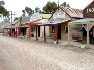
Old Tailem Town Pioneer Village.

Old Tailem Town Pioneer Village can be found 5 kilometres north of Tailem Bend or 90 kilometres east of Adelaide on the Princess Highway.

First established in 1982, Old Tailem Town allows it's visitors to take a walk back in time and see what life was like all those years ago.


The area illustrates what life for the South Australian settler was like from 1860 through to 1960.

The well appointed tea and coffee room allows everyone to enjoy a self paced visit to the area without being too rushed.

Monday, July 30, 2007

Mannum Sunrise.


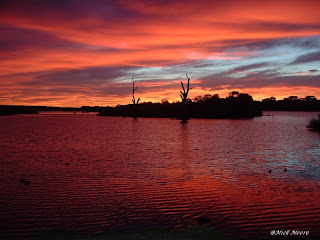
You always know that you have a good start to the day when you get a pretty sunrise like this one.


This part of the day was captured at Mannum on the River Murray in South Australia.

After starting off a red colour, it turned gold before disappearing to a perfect day.

Sunday, July 29, 2007

Birds.


The common seagull, found where there is sea water and fish & chips. It never seems to amaze me how their radar lets them know that there is food around.


The Rainbow Lorikeet is also a common bird in Australia with it's bright colours making it a favorite at a lot of tourist locations.

If they are in the trees within a street and you park your car under the tree, they quickly do their business all over it.

Saturday, July 28, 2007

Burra Creek Gorge.


Some places appeal to people more than others and for water reflection photography, this location at Burra Creek Gorge has plenty to offer.


It is the sort of spot that has a bit of everything that you want from very still water, large trees and at the right time of the year, plenty of blue sky and green grass.

The location of Burra Creek Gorge is described in an earlier posting.

Thursday, July 26, 2007

Miniature Village.

The Wild Rose Garden and Tearoom is situated a few kilometres Adelaide side of Victor Harbor on the Adelaide to Victor Harbor road. As well as the Tea Room where you can enjoy some lovely scones with jam and cream, there is also a Rose Garden and Miniature Village.


To walk around and view the Miniature Village which is spread out amongst lush green scenery and manicured lawn areas, it can make for a relaxing afternoon in the winter sunshine when combined with the hot scones with jam & cream.

Wednesday, July 25, 2007

Low Water.

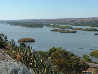
As Australia is experiencing one of its toughest droughts, I thought that I would show these two photos of the River Murray at Mannum South Australia.

The first photo was taken in mid 2005 with a reasonable amount of water in the river. Compare it to the photo below which was taken two years later and check the difference.


This photo was taken mid 2007 and shows how the lower water level of the main river is starting to have an effect on the flood areas to the side.

Although I have never seen it looking like this before, it makes us appreciate what it should be like and can only hope that in time, it returns to it's natural water level.

Tuesday, July 24, 2007

Horseshoe Bay.


This delightful bay is located at Port Elliot which is on the Fleurieu Peninsula between Goolwa and Victor Harbor South Australia.

The beach is very popular with holiday makers who take advantage of the many styles of accommodation within the area.


While the waters within the bay are protected for beach goers, the water further out, can be at times, a very deep and pretty blue to look at.

Monday, July 23, 2007

Victor Harbor.

Granite Island is a small island at Victor Harbor 80 kilometres south of Adelaide. It is a busy sea side tourist destination which is very popular with families and the likes.

Granite Island is a short walk over the causeway or if you would rather enjoy a ride on the horse drawn tram, there are two operating during the busy periods.


Once on the island, there are walking trails which will take you around the outside of the island or there is one that will go over the top and over to the other side.

There are guided walks during the night to view the penguins as they come home to their burrows from their fishing trips.

Saturday, July 21, 2007

Palm Valley.


Palm Valley is 138 kilometres west of Alice Springs in the Northern Territory and forms part of the 46,000 hectares Finke Gorge National Park.

Access to Palm Valley is by high clearance four wheel drive vehicle only along the road which follows the Finke River bed.


There is a campground at Palm Valley for overnight visitors to use before they take the walk through the centre of the Cabbage Palm river bed and returning via the top section which gives you an excellent view of the Palms from high up.

Friday, July 20, 2007

Cleland Wildlife Park.

Imagine what you would do next if you come across this Monitor Lizard when you were not expecting it. I think most of us would be heading for a toilet.

This large fella can be found at the Cleland Wildlife Park in Adelaide South Australia.


Like so many of the animals at Cleland, it is all rest and no work. Visitors have the luxury of walking amongst most of the animals within their huge holding areas.

Even this kangaroo isn't put off by people strolling by.

Thursday, July 19, 2007

Ormiston Gorge.


Ormiston Gorge forms part of the West MacDonell Ranges out from Alice Springs in the centre of Australia and has a near-permanent waterhole, estimated to be up to 14m deep at its southern end.


As well as the beauty of this location, there is also a well maintained camping area near Ormiston Gorge which allows it's visitors plenty of time to enjoy the area.

Wednesday, July 18, 2007

Murphy's Haystacks.


These granite rocks or inselbergs are located on a hill top some thirty nine kilometres south east of Streaky Bay on the western side of Eyre Peninsula of South Australia.


It has been noted in history that the area gained it's name from people who viewed the inselbergs from a distance thinking that they we in fact a hay stack. More can be read on this location by clicking here.

Monday, July 16, 2007

Flowers.


Found these and many more growing in the wild at a place called Hogwash Bend which is an area on the River Murray in South Australia.


The flower bush is very tolerant to a low rainfall and adds colour to the immediate area where it is found growing.

Sunday, July 15, 2007

Redbank Gorge.


Redbank Gorge forms part of the West MacDonell Ranges out from Alice Springs in the centre of Australia.


We were unaware of this Gorge until we spotted the sign post leading into the Gorge and as such did not realize at the time that there was approximately a twenty minute walk to reach the main water pool in the Gorge. The water seen here is what has remained after some recent rain in the area.

Saturday, July 14, 2007

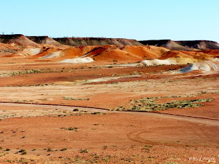
The Breakaways.


While flicking through some of my older photos, I come across these two of The Breakaways and though I would put them on my blog to go with an earlier posting of the same area.


This is a very colourful location and we are looking forward to revisiting the area next month on our way to Alice Springs in the Northern Territory.

Perhaps we will be able to captures some more shots to post here if the weather is kind to us while there.

Friday, July 13, 2007

Geikie Gorge.

Geikie Gorge can be found in the top part of Western Australia in the Kimberly region. It is located 20 kilometres out west from the town of Fitzroy Crossing or 280 kilometres east of Derby.

The area is open to the public from 6.30am until 6.30pm each day unless the area has been flooded during the wet season that runs from December through to March each year.


During the wet season the water will rise by as much as 16.5 metres making this river one of the fastest flowing rivers in the world. The white colours of the walls indicate the water level during the wet season.

The water supports sawfish, stingrays, freshwater crocodiles and many other fish species. There are public toilets, a shelter shed, BBQ facilities and large picnic area for visitors to use while visiting.

Thursday, July 12, 2007

The Red Centre.


The locations around the middle of Australia is often referred to as "The Red Centre" and looking at these two photos, it is easy to see where the name comes from.


The two photos here were taken near Yulara, west of Alice Springs. It is typical of the country in the centre of Australia with the deep rich red colours and the bright green bushes growing in the same area.

While the dirt is red, it is by no means dirty. When you walk in this dirt, it falls straight off of your shoes without leaving any dirty and dusty tell tales behind. It behaves a lot like beach sand.

Wednesday, July 11, 2007

Ellery Creek Big Hole


Ellery Creek Big Hole is located 90 kilometers west of Alice Springs in the West MacDonell Ranges along Namatjira Drive.

Like all of the gorge areas in the West MacDonell Ranges, there are walking trails that can be enjoyed by the tourist while visiting the area.


Once the walk has been completed if that is your thing, there is ample shade to rest under while one enjoys a picnic. The water pool at Ellery Creek Big Hole is permanent and swimming is permitted.

Tuesday, July 10, 2007

Stanley Chasm.

Stanley Chasm is a part of the West MacDonell Ranges which can be found 30 kilometers to the west of Alice Springs in the Northern Territory.

The most impressive time of the day to visit this area is when the midday sun is high above allowing the sun rays to light up the red walls of the chasm.


There is a car park and cafe at the entrance to the area and once leaving here, it is a short 20 minute easy walk to reach the chasm.


We found this plant growing on the side of one of the chasm walls. It would have to be one of the most drought tolerant plants alive to survive on minimal dirt on a stone face.

Monday, July 9, 2007

Broken Hill Sculptures.


These are just two of the twelve Wilcannia sandstone sculptures that are located out from Broken Hill in the western part of New South Wales in Australia.


It would be easy to spend a few days photographing these sculptures from early day break to late afternoon with the setting sun behind them creating a red glow. The wonders of what can be achieved if only there was the time to attempt it.

Sunday, July 8, 2007

Saturday Drive.

While out for a Saturday drive yesterday, these two photos were captured during a period of limited sunshine.

This one is of the Semaphore CBD taken from the lawn area by the jetty which was shown in yesterday's blog.


It was a cold winters day and the wind was chilly when we were at this spot which is the bridge going over to Torrens Island, an area of Adelaide South Australia.

Although not show here, there was a keep fisherman standing in the water trying to catch a fish. Either he was keen for a feed of fish, or enjoyed fishing that much that it killed the effects of being cold.

Saturday, July 7, 2007

Semaphore Jetty.


During the early evening of Thursday July 4th 2007 Adelaide experienced a king tide which with the heavy winds, caused extensive damage to the Semaphore jetty, one of Adelaide's several coastal jetties.


The jetty is now closed to the general public until the repairs have been completed. The relentless pounding of the waves on the underside of the jetty planks was too strong and eventually lifted most of the outer section from their bearers.

Friday, July 6, 2007

Head of Bight.

The Head of Bight is a part of South Australia and is located 78 kilometres west of Yalata and 20 kilometres to the east of Nullarbor Roadhouse. Some of the cliffs are as high as 65 metres above the sea.

The Bunda Cliffs are a magnificent sight in themselves and stretch in an unbroken line for 200 kilometres to the Western Australian border.


The top photo was taken looking west towards Perth and away from the sun. The photo to the left was taken at the same time and looking towards the east early one morning which unfortunately has been effected by the morning sun.

There are many lookouts along the Head of Bight for tourist to view this fascinating part of the coastline.

Thursday, July 5, 2007

Coober Pery Underground.

Coober Pedy is located 846 km north of Adelaide South Australia and is considered to be the "Opal Capital of the World" with opals first discovered in the area around 1915.

With the outside temperatures often reaching a hot 45 degrees Celsius in the shade, it is no wonder most of the dwellings are found underground.


These two photos show an underground Art Gallery and Jewelers shop which has been set up to escape the outside heat.

Wednesday, July 4, 2007

The Olgas.


Kata Tjuta, better known as the Olgas, are only 30 kilometres on from Yulara and Ayers Rock in the southern part of the Northern Territory.

The Olgas are made up of some 36 rounded domes with the tallest one being called Mt. Olga which is a taller than Ayers Rock.


Because there are so many domes that make up the Olgas and unlike Ayers Rock, visitors can walk through the centre of the Olgas on several walking trails. No trip to Ayers Rock is complete unless you visit the Olgas as well.